HiGIS - Semiautomatic Processing of Historical Maps (SoSe 2015)
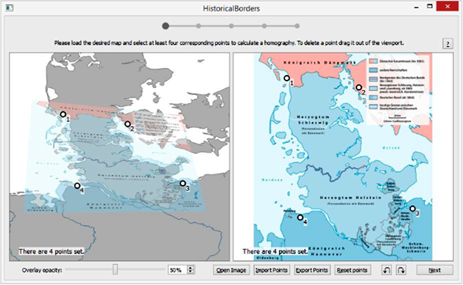
In the project a software tool is developed that is able to extract borders from historical maps and relate them geographically to present day maps. In addition, this tool should be able to store the position of the border (geographic coordinates) in Geo-JSON vector format, which facilitates further processing and use on software platforms.