HiBo - Automated Image Processing of Historical Maps (SoSe 2014, WiSe 2014/15)
- Project goals
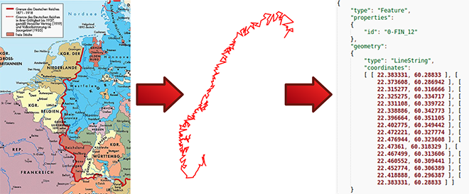
- User-guided semi-automatic feature extraction algorithm for local polylines
- Integrate the algorithm into the open-source geographic information system QGIS (Python or C++ Interface)
- Use georeferencing to assign GPS coordinates
- Implementation
- MATLAB / Octave
- C / C++
- Python