No edit summary |
No edit summary |
||
| (11 intermediate revisions by the same user not shown) | |||
| Line 1: | Line 1: | ||
[[File:Snowkrash im Fluegel mit USB Ventilatoren.jpg|695px]] | [[File:Snowkrash im Fluegel mit USB Ventilatoren.jpg|695px]] | ||
== About == | == About == | ||
SnowKrash ([[Satellite Border Footprint/Ursel Quint|Ursel Quint]] & [[Satellite Border Footprint/Barry L. Roshto|Barry L. Roshto]]) is a Media Art Duo working together since June 2009.<br /> | |||
They have produced five Audio-Visual performances, five installations and ten films. * [http://www.snowkrash.org Snowkrash] | They have produced five Audio-Visual performances, five installations and ten films. * [http://www.snowkrash.org Snowkrash] | ||
[[File:Sniffing at the Florian.jpg|thumb|EMF sniffing atop the Florian Radio Tower - Photo by Frank Hoppe]] | [[File:Sniffing at the Florian.jpg|thumb|EMF sniffing atop the Florian Radio Tower - Photo by Frank Hoppe]] | ||
| Line 9: | Line 9: | ||
And, indeed there we some moments in which it was profitable. | And, indeed there we some moments in which it was profitable. | ||
<flashmp3 id="Funkturm EMF original.mp3">Funkturm EMF original.mp3</flashmp3><br /> | Funkturm Florian electromagnetic field recording <flashmp3 id="Funkturm EMF original.mp3">Funkturm EMF original.mp3</flashmp3> | ||
<br /> | |||
<br clear="all"/> | |||
== Dish Fishing == | == Dish Fishing == | ||
| Line 27: | Line 28: | ||
* [[File:GPS-track Dortmund.gpx]] | * [[File:GPS-track Dortmund.gpx]] | ||
* [http://www.openstreetmap.org/user/Roshtobl/traces/840611 Raw Track in Open Street Maps] | |||
* [[File:Snowkrash_Dish_Fishing_Dortmund_Images_4_Google.doc]] | |||
* [[File:Snowkrash_Dish_Fishing_Dortmund_Images_4_Google.pdf]] | |||
* [http://maps.google.com/maps?f=q&hl=en&geocode=&q=https:%2F%2Fspreadsheets.google.com%2Fpub%3Fkey%3D0AhwdNCFkQwNmdDlqQTU0VWJoNDNYUUU2OVBqaUJQaWc%26output%3Dtxt%26gid%3D0%26range%3Dkml_output%26time1%3D4045923 Dish Fishing Images in Google Maps/Earth] | * [http://maps.google.com/maps?f=q&hl=en&geocode=&q=https:%2F%2Fspreadsheets.google.com%2Fpub%3Fkey%3D0AhwdNCFkQwNmdDlqQTU0VWJoNDNYUUU2OVBqaUJQaWc%26output%3Dtxt%26gid%3D0%26range%3Dkml_output%26time1%3D4045923 Dish Fishing Images in Google Maps/Earth] | ||
[[File:Grey_Dishes.jpg]] | |||
<br clear="all" /> | <br clear="all" /> | ||
| Line 89: | Line 94: | ||
[[Category:Satellite]] | [[Category:Satellite]] | ||
[[Category:Satellite]] | |||
[[Category:Satellite]] | |||
[[Category:Satellite]] | [[Category:Satellite]] | ||
Latest revision as of 14:13, 12 October 2010
About
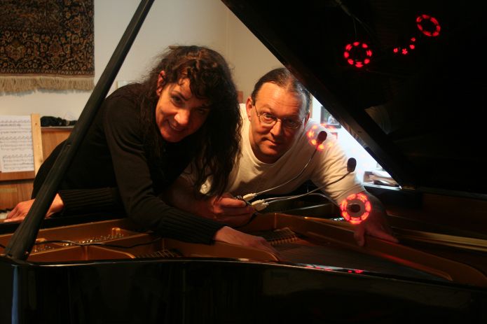
SnowKrash (Ursel Quint & Barry L. Roshto) is a Media Art Duo working together since June 2009.
They have produced five Audio-Visual performances, five installations and ten films. * Snowkrash
Why we were there
We are constantly looking for new Sound Sources, upon reading the call for the workshop, we thought that there must certainly be some interesting sound to be collected from the satellite infrastructure.
And, indeed there we some moments in which it was profitable.
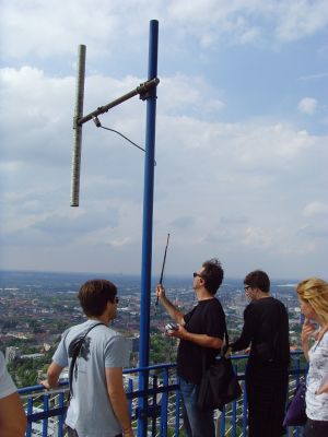
Funkturm Florian electromagnetic field recording <flashmp3 id="Funkturm EMF original.mp3">Funkturm EMF original.mp3</flashmp3>
Dish Fishing
GERMAN - Feldarbeit
Im Rahmen des Workshops haben wir uns entschlossen, einige ausgewählte Dortmunder Straßen daraufhin zu untersuchen, ob und wie viele Satellitenschüsseln sich an Wänden und Dächern der Häuser befinden. Unsere Dokumentation besteht aus mehreren Elementen: Wir haben die Satellitenschüsseln in einem vorher abgesteckten Karrée der Dortmunder Nordstadt fotografiert, gezählt und kartographisch eingeordnet. Das Ergebnis lässt sich als Layer bei Google Earth oder Google Maps anschauen.
In ihrer Eigenschaft als komplexitätsreduzierende Zeichen sind die Empfangsschüsseln nicht nur Bestandteile des Systems „Satelliten“, sondern gehören auch in den Bereich der Gentrifizierung, eine soziologische Komponente des Städtebaus. Warum sollte man sie nicht ebenso als optisches Phänomen, `fast´ natürlicher Bestandteil der urbanen Fauna, betrachten? Einige unserer Fotos legen dies durchaus nahe...
ENGLISH - Field Work
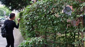
As practical part of the workshop, we chose to do some „Field Work“ in a section of northern Dortmund, searching roofs and façades for satellite dishes. We counted, photographed and filmed all of the dishes in the courtyards of Uhlandstrasse 35 – 43 and a stretch of Mallinckrodtstrasse from 165 to 221. In the Schuetzenstrasse we made two other photos, but this street was not comprehensively catalogued as were the first two areas. Another “control” image was made of an area in which almost identical buildings, built by the same building company reveal no visible evidence of satellite dishes. Using the logged GPS tracking coordinates of our excursion, we made a layer in which the images can be viewed in Google Earth or Google Maps.
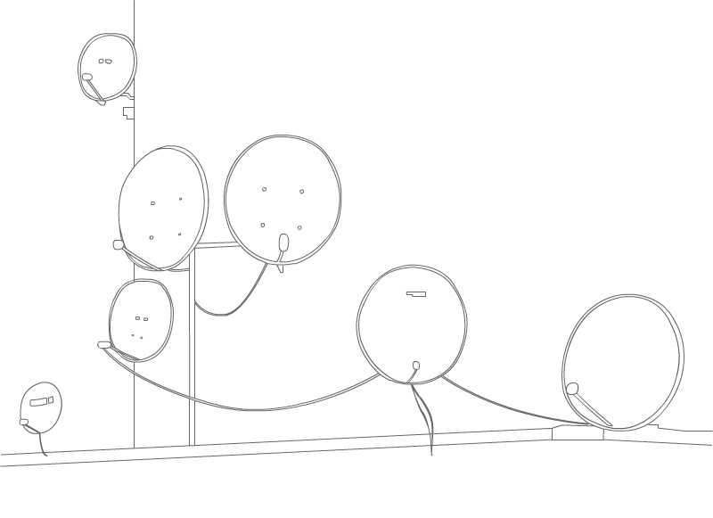
In their capacity as “complexity-reducing-Signifiers” (see Statement to the workshop below), the satellite dishes are not only a part of the system “satellite”, but are also to be considered in the realm of gentrification, a sociological component of urban development. But, why should we not consider them simply as optical phenomena, an “almost” natural element of the urban fauna. Some of our photos do indeed reveal a kind of organic organisation...
Statement to the workshop
(for English scroll down)
GERMAN - Was kann einen Künstler dazu bewegen, sich mit Satelliten zu beschäftigen?
Das war eine der Fragen, die sich uns vor und nach dem Workshop auf ganz unterschiedliche Art gestellt hat, auf die wir teils überraschende, teils vorhersehbare, teils aber auch gar keine Antworten gefunden haben…
Wir haben als Medienkünstler einen Hintergrund als klassisch ausgebildete Musiker; wir nehmen die Welt mit den Ohren wahr und sind unter Anderem daran interessiert, akustische Phänomene aufzuspüren und damit zu arbeiten, auch solche, die eigentlich unhörbar, vielleicht sogar unsichtbar sind, und die wir mit Hilfe dazu geeigneter Instrumente dem menschlichen Ohr zugänglich machen können. Wir haben uns also gefragt, ob das im Zusammenhang mit Satelliten zu spannenden Resultaten führen könnte.
Im Rahmen des Workshops wurde oft hervorgehoben, daß Satelliten im Verborgenen arbeiten, daß man sie selbst nicht wahrnimmt - was mit ihrer räumlichen Entfernung zusammenhängt - und auch sehr wenig über sie weiss, obwohl sie doch mittlerweile eine große Rolle in unserem Alltagsleben spielen.Sichtbar werden sie allenfalls durch die Satellitenschüsseln, die also als "Zeichen" fungieren.
So war unsere erste Idee, mit Hilfe von EMV - Schnüfflern und Kontaktmikrophonen, die imstande sind, elektromagnetische Felder und Strömungen aufzuspüren und so zu verstärken, dass sie mit dem menschlichen Ohr wahrgenommen werden können, die "Zeichen", die die Satelliten auf der Erde repräsentieren, zum Klingen zu bringen,um mit den gefundenen Klängen gegebenenfalls weiter zu arbeiten.
Eine Idee, die wir hinsichtlich dieser Klänge verfolgen wollten, war, eine akustische (als Alternative zur geographischen) Land -oder Stadtkarte zu erstellen, und in diesem Rahmen auch die Satellitensounds einzusetzen.
In der Tat lassen sich die Satellitenschüsseln und Empfangsantennen zum Klingen bringen, jedoch ist das Ergebnis nicht allzu befriedigend. Viel spannendere Klänge haben wir bei unserer Recherche in Dortmund auf dem Funkturm gefunden, ebenfalls ein Gerät zum Empfang und zur Weiterverarbeitung von Signalen von Kommunikationsmedien, allerdings nicht von Satelliten gesendet.
Die eher unspezifischen Satellitenschüssel-sounds eignen sich somit nicht unbedingt für die akustische Landkarte; sie würden sich nicht absetzen von den meisten anderen Klängen, die wir elektronischen Geräten entlocken können.
Ohne die Idee, Satelliten und ihre Hilfsgeräte hörbar zu machen aufgeben zu wollen, spricht doch nichts dagegen, sich ihnen über einen anderen Weg zu nähern, es muss nicht unbedingt der über ihre Klangqualitäten sein.
Lisa´s engagierte und kompetente Vermittlung ihres Wissens bot genügend Anregung für andere Ideen. Das "System (Luhmann) Satellit " besteht ja aus weit mehr als aus den Satellitenkörpern und den mit ihnen verbundenen Geräten. Satelliten als Kommunikationsmedien haben eine bedeutende politische Dimension, durch die enorme Reichweite ihrer Signale verändern sie das Verhältnis von National und International und sind wichtige Bestandteile unserer Infomations- und Mediengesellschaft, aber auch wesentlich für zivile und militärische Einflussnahmen. Die Satellitenschüsseln sind interessante Objekte soziologischer und kulturwissenschaftlicher Untersuchungen, was auch für den Umgang der Nationalstaaten mit ihren Satelliten im Weltraum (der immerhin noch nicht in nationale Hoheitsgebiete aufgeteilt ist) gilt.
Unsere Frage nach den künstlerischen Aspekten ist ja nicht leicht zu beantworten, und Recherchen zur "Satellitenkunst" lassen erkennen, dass zwar die Entourage der Satelliten viel Material bietet - "Satellitenkunst" ist häufig einfach "Weltraumkunst", die auch die Beschäftigung mit den Planeten oder mit Sphärenklängen im All einschließt- ,die Satelliten selbst aber merkwürdig blass bleiben, in den meisten Installationen zum Thema auch problemlos von anderen Kommunikationsmedien ersetzt werden könnten, ohne daß sich der Charakter des Werkes wesentlich ändern würde.
Die Schüsseln allerdings sind auch im systhemtheoretischen Sinne ein Mittel der Komplexitätsreduzierung, und damit eigentlich die einzigen Obkjekte, die wir in einem sinnlichen Zusammenhang erfassen können. Zunächst verworfen als banale Geräte, die bestenfalls Lieferanten interessanter Klänge sein können, erkennen wir sie nun als spezifische – und einzig wirklich „brauchbare“ Objekte für unsere künstlerischen Projekte.
Ein Videoprojekt über das Ruhrgebiet, an dem wir arbeiten und das mit den optischen und akustischen Signifika der Region spielt, soll eine zusätzliche Dimension erhalten, die sich damit beschäftigt, wie das Ruhrgebiet im Weltall repräsentiert ist (also: welche Satelliten „hinterlassen“ ihre footprints in dieser Gegend); auf diese Art schaffen wir eine Umkehrung des Verhältnisses von Signifikat und Signifikant, so wie es zunächst besteht zwischen den unsichtbaren Satelliten und ihren Signifikaten, den Schüsseln. Wir untersuchen und `dokumentieren´, wie Ruhrgebiet im All vertreten ist, wieviele und welche Satelliten sind hierfür zuständig, wie sieht es aus, wenn man diese Satelliten abbildet?
Wir greifen dafür zurück auf Filme und Fotos, die wir während des Workshops auf einem Gang durch die Dortmunder Nordstadt gemacht haben. Sie dokumentieren die Häufigkeit und Gerichtetheit der dort befindlichen Satellitenschüsseln. Indem die Schüsseln auf ihre Signifikanten im Weltraum verweisen, wollen wir sie in unserem Videoprojekt als die Vertreter der Transzendenz darstellen, nachdem die beiden ersten Teile sich mit der Geschichte und der Gegenwart der Region auseinandergesetzt haben. In diesem Zusammenhang werden die Klänge, die wir (angeregt durch den Workshop übrigens) in anderen Städten der Region von Satellitenschüsseln abgenommen haben, auch eine Rolle spielen.
ENGLISH - What could motivate an artist to become interested in satellites?
This was one of the first questions that came to mind as we were considering participating in the Satellite/Border/Footprint workshop. We pondered this question before, during and after our weekend in Dortmund. We asked ourselves this question in a variety of ways, assuming various view points. The answers we were able to formulate were at times what we had expected, in other instances they appeared quite surprising and more often than not, we found no answers at all...
Our Media Art is inevitably influenced by our background as classically trained musicians. We experience the world primarily through our sense of hearing and are avidly interested in seeking out acoustical phenomena to be used as material in our work. Even those that are inaudible, perhaps invisible in their natural state can be translated into a realm discernible to the human ear with the assistance of appropriate devices.
A fundamental interest of ours in this new milieu of satellite technology and its artistic implementation lay exactly in their indiscernible impact on our environment, embodied in the title of the workshop: the “footprint”. Could this lead us to new, interesting acoustical material?
A central theme of the workshop was the clandestine presence of satellites in our daily lives. Although essential to contemporary communication technology, most of us do not notice them. We do not know the names of the satellites that bring us the information necessary for the daily weather forecast. The use of satellite technology for the transmission of live TV reporting has become so commonplace that it is no longer interesting to bill a newscast from a correspondent on the other side of the world as “via satellite”.
Their most visible “signifier” is the satellite dish. So, we immediately thought: do they make noise?
Could we, with help from devices that “sniff out” and amplify electromagnetic fields and/or contact microphones that detect the slightest vibrations, make these “signifiers” into something that could give us an insight, an interpretation of the “signified”? Could we find some “satellite-specific” noise?
We thought it would be interesting to construct an acoustical map of the region in which the satellite sounds would be integrated. It is indeed possible to sonify satellite dishes, although the results of our experiments during and after the workshop failed to produce any satisfactory findings. The sound collected on our excursion to the radio tower Florian in Dortmund was far more interesting. The tower also contains devices for the reception and processing of communication signals, only apparently not satellite signals.
The electromagnetic sound collected from the satellite dish does not emerge out of the rest of the Hertzian ambiance of the city. It is not unique and therefore not specifically interesting in the context of the acoustical map. Without completely giving up on the idea of making satellites and their support devices audible, we looked for alternative ways of approaching the problem of finding some “specific” quality of satellite technology that would interest us artistically.
Lisa's engaging and competent presentation of her research provided plenty of other aspects that served as stimulation for our own investigations. The “System (Luhmann) Satellite” is much more than simply the physical machinery in orbit and their support infrastructure on the ground. Satellites deployed as communication media have a significant political dimension, due to their vast transmission range they affect the relationship between the national and the international. They are an essential part of our information and media culture, as well as paramount to the influence of civil and military powers. The satellite dish is an object of interest in sociological and cultural studies, as is the the modus operandum of satellite placement in space (which remains one of the last frontiers that has not been divided into national territories.)
Our question about the artistic aspect of satellites is not easily answered. Research into the realm of “Satellite Art” reveals that the mass of work is impressing, but the object “Satellite” itself remains remarkably pale. It seems that in most installations the medium satellite could easily be replaced by other communication media without considerably changing the character of the work. “Satellite Art” is often simply “Space Art”, concerning itself with natural planetary objects or the music of the spheres, etc.
The satellite dish, on the other hand, is an object that (in the context of Luhmann's System Theory) serves as a means of “Reduction of Complexity”, and therefore a defining factor in the system, the only object in our opinion that has a sensual context. With this realization we were able to view this object that we at first thought banal and pedestrian (at best a source of interesting noise) as the most important part of the system, the only object that is “satellite system specific”, and subsequently as object of interest to our artist endeavours.
Our current video project about the Ruhr region, which plays with significant optical and acoustical impressions from the area, will be augmented by a section dealing with the representation of the region in space, or which satellites “leave” their footprints in this part of Germany. We will then reverse the relationship of the signifier and the signified, as it is at first apparent in the manifestation of the invisible satellites through their signifiers, the satellite dishes. We will examine and “document” how the Ruhr region is represented in space and which satellites are responsible for this representational work. Finally, we will explore the question of how it might look when we represent the “representers”.
We will use films and photos from an excursion through northern Dortmund made during the workshop. These images are a documentation of the density and position of satellite dishes found in the area. Since these dishes direct attention to their signified satellites in space, we will present them in our video project as agents of transcendence, contrasting the first two parts which deal with the past and present. In this context we will also include sights and sounds of satellite dishes from other cities in the region.


