Titan (working title)
“One who knows the depths of the whole sea, and keeps the tall pillars who hold heaven and earth asunder”
Homer, Odyssey
In the Greek mythology “Atlas” refers to a Titan that was punished by Zeus to carry the weight of the heavens and the earth forever on his shoulders. I always thought that this Atlas was the origin of the term atlas but as I began researching maps and map making I came across the Mauritanian King Atlas, who supposedly made the first celestial globe. It was this Atlas Gerardus Mercatror depicted on the title page of the “Theatrum Orbis Terrarum” in 1570, the first modern world atlas.
Still, the thought of the Grecian Atlas essentially carrying the world around on his shoulders was what reminded me of travel atlases and road maps. These are made for easy review during travels so the maps are largely zoomed and are used as reference for the depicted area.
For my project I want to create a world map in the folded form of a travel atlas.
This way one can carry the world like a modern day Atlas- just with a little less weight.
Using a topological map I want to relay information concerning the current earth population. I will disregard the normal scale and the spatial relations of a world map as I’m going to divide the countries into different categories according to their population. Each country in a category will be given the same proportions on the map so that obvious spatial discrepancies arise. To represent the unique individuals that make up the world population I will draw the map using only dots of differing size/strength.
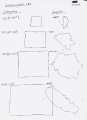
possible scaling
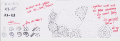
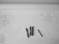
example with notes
example


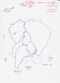
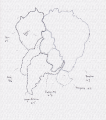
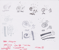
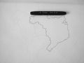
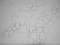
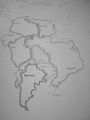
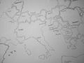
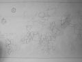
The charting of my country-map I began by drawing a sketch of each country using these frameworks. I tried to maintain the original form of each country, but due to the dimensional differences and my wish not leave unnecessary gaps and white space most borders changed to adapt to the new proportions, some countries even moved from their original location to a point nearby. In the next step I filled my chart figuratively with life, replacing the rough sketch with my dot-combination. Lastly I added a border and compass rose for orientation and as reminder of the ancient maps I had in my mind, when I began my project.
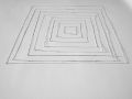
border combinations 1
border combinations 2
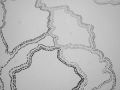
framework
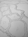
charting 1
charting 2
charting 3

charting 4
charting 5
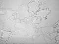
charting 6
charting 7
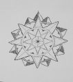
compass rose
map 1
map 2


As mural the map is a constant reminder of all the other people in this world and how much weight they have.
Folded, my country-map can be carried around like a travel atlas and you have the world in your pocket.
mural
cover documentation


Note: Due to the folding and following changes of the map, the borders now appear sligthly misshappen.