Page title matches
File:Satellite-bar.jpg (3,168 × 2,376 (4.81 MB)) - 15:58, 8 August 2010
File:Satellite-bar-lb.jpg (2,154 × 2,970 (4.3 MB)) - 17:02, 8 August 2010
File:Satellite-bar2-lb.jpg (3,168 × 2,376 (4.79 MB)) - 17:09, 8 August 2010
File:Satellite-bar3-lb.jpg (2,376 × 3,168 (5.2 MB)) - 17:11, 8 August 2010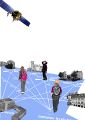
File:BfU Satellite Sailors.jpg Büro Für Unabwägbarkeiten, Satellite Sailors, Oldenburg 2009(2,480 × 3,508 (2.2 MB)) - 08:00, 3 August 2010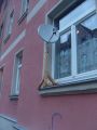
File:Satellite dish Weimar.jpg Satellite dish in Weimar(2,304 × 3,072 (2.15 MB)) - 15:15, 6 October 2010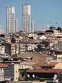
File:İstanbul satellite dishes.jpg (1,944 × 2,592 (1.98 MB)) - 16:35, 17 June 2012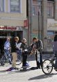
File:BfU Satellite Sailors 3.jpg Büro für Unabwägbarkeiten, Satellite Sailors, Oldenburg 2009(2,541 × 3,638 (4.43 MB)) - 08:58, 3 August 2010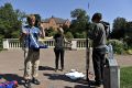
File:BfU Satellite Sailors 4.jpg Büro für Unabwägbarkeiten, Satellite Sailors, Oldenburg 2009(4,256 × 2,832 (5.79 MB)) - 09:06, 3 August 2010
File:BfU Satellite Sailors Street.jpg Büro für Unabwägbarkeiten, Satellite Sailors, Oldenburg 2009(1,600 × 1,200 (1.07 MB)) - 09:11, 3 August 2010
File:BfU Satellite Sailors 1.jpg Büro Für Unabwägbarkeiten, Satellite Sailors, Oldenburg 2010 (Photo: Niels Mlynek)(4,256 × 2,832 (4.75 MB)) - 08:15, 3 August 2010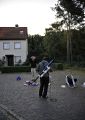
File:BfU Satellite Sailors 2.jpg Büro für Unabwägbarkeiten, Satellite Sailors, Oldenburg 2010(2,832 × 3,987 (4.64 MB)) - 08:51, 3 August 2010
File:Low resolution carry on satellite dish.jpg (258 × 348 (77 KB)) - 19:45, 3 August 2010


Page text matches

File:GPS-track Dortmund.gpx Holux waypoints and paths during the Satellite Border Footprint Workshop(83 KB) - 23:08, 2 August 2010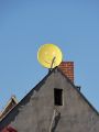
File:Smiley dish.jpg Smiley satellite dish in Altenburg(2,736 × 3,648 (1.93 MB)) - 15:23, 6 October 2010File:Satellite dish Weimar.jpg Satellite dish in Weimar(2,304 × 3,072 (2.15 MB)) - 15:15, 6 October 2010
File:SBF Workshop13.jpg Satellite Border Footprint(5,442 × 2,015 (2.41 MB)) - 09:25, 14 October 2010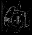
File:Walkman constellation web.png part of the Satellite Zodiac(680 × 737 (68 KB)) - 23:08, 13 June 2010File:Snowkrash Dish Fishing Dortmund Images 4 Google.doc A list of images of the satellite dishes used in the Google Maps/Earth Layer. These images and the original p(44 KB) - 12:57, 11 October 2010File:BfU Satellite Sailors 2.jpg Büro für Unabwägbarkeiten, Satellite Sailors, Oldenburg 2010(2,832 × 3,987 (4.64 MB)) - 08:51, 3 August 2010File:BfU Satellite Sailors 3.jpg Büro für Unabwägbarkeiten, Satellite Sailors, Oldenburg 2009(2,541 × 3,638 (4.43 MB)) - 08:58, 3 August 2010File:BfU Satellite Sailors 4.jpg Büro für Unabwägbarkeiten, Satellite Sailors, Oldenburg 2009(4,256 × 2,832 (5.79 MB)) - 09:06, 3 August 2010File:BfU Satellite Sailors 1.jpg Büro Für Unabwägbarkeiten, Satellite Sailors, Oldenburg 2010 (Photo: Niels Mlynek)(4,256 × 2,832 (4.75 MB)) - 08:15, 3 August 2010File:BfU Satellite Sailors Street.jpg Büro für Unabwägbarkeiten, Satellite Sailors, Oldenburg 2009(1,600 × 1,200 (1.07 MB)) - 09:11, 3 August 2010File:BfU Satellite Sailors.jpg Büro Für Unabwägbarkeiten, Satellite Sailors, Oldenburg 2009(2,480 × 3,508 (2.2 MB)) - 08:00, 3 August 2010

