

Thesis Topic - Playing Across Boundaries
A location-based game that uses spatial analysis to build communities across neighborhood silos
Dr.-Ing. Martin Bielik · Chair of Informatics in Architecture and Urbanism · Bauhaus-Universität Weimar
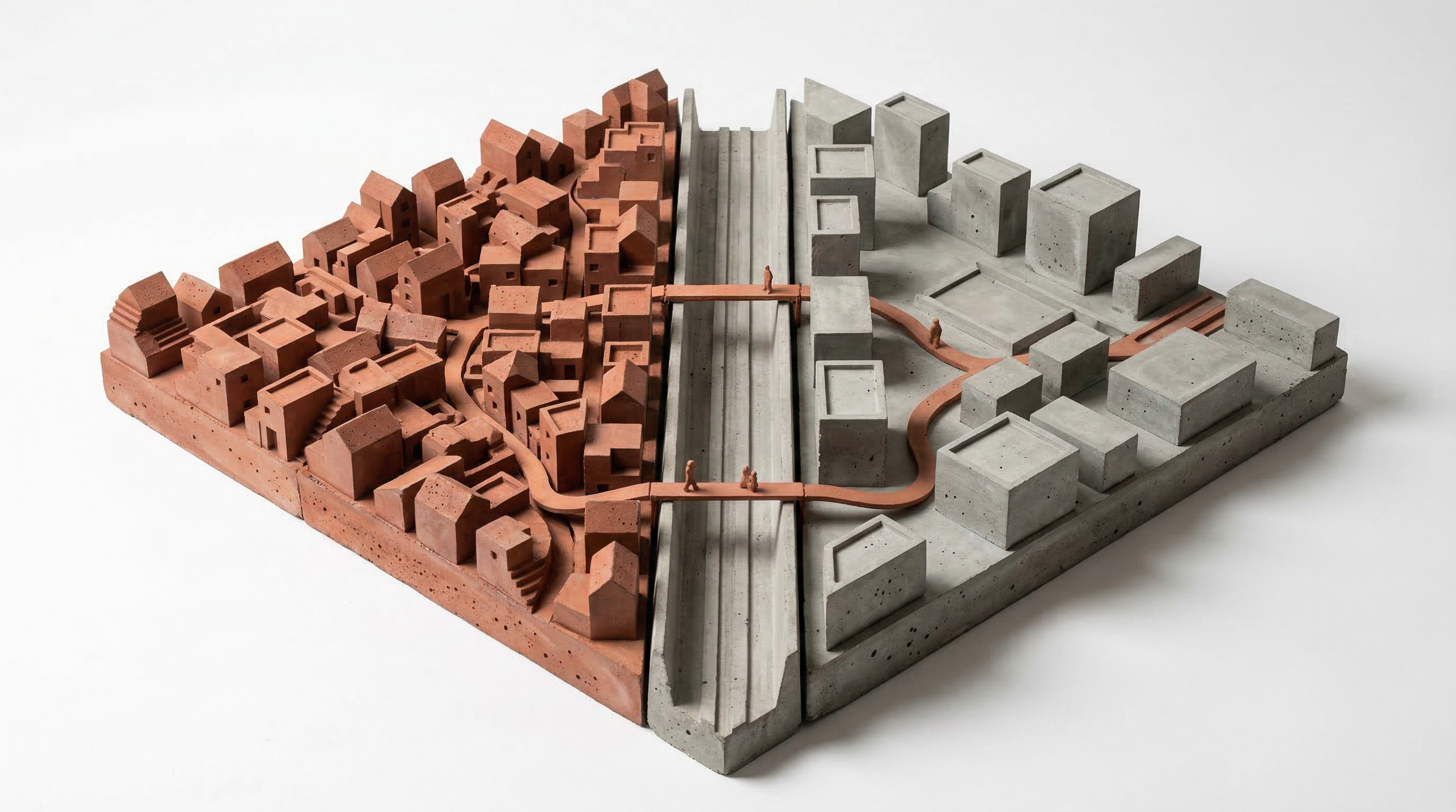
Cities are full of invisible walls. The railway line, the highway, the park nobody crosses after dark — they split neighborhoods into bubbles where people live side by side but never meet. What if a game could make those walls visible, and then give you a reason to cross them?
Summary
Urban neighborhoods form social silos shaped by infrastructure, topography, and land use. People develop routines that keep them within familiar streets, and the spatial boundaries that discourage crossing are largely invisible to residents. Traditional interventions connect people through physical changes to environment which is costly and slow; digital tools connect people across distance but rarely across the street.
This thesis builds a location-based game that uses spatial analysis to map each player's personal spatial boundary — the invisible edge of their everyday territory — and generates individualized quests that pull them beyond it. Quests may involve physical artefacts that must be found, exchanged, combined, or carried across boundaries, turning objects into vehicles for interaction between people who would otherwise never meet. The game is tested with real participants in a real urban context, measuring whether players cross their personal boundaries, interact with people outside their usual silo, and form new ties through shared play.
Description
1. Problem Statement
Urban neighborhoods form social silos. People develop routines that keep them within familiar streets, familiar faces, familiar assumptions about "the other side." These boundaries are not random — they are spatial. Infrastructure, topography, land use patterns, and accessibility networks create edges that discourage crossing. The result is fragmented communities, persistent stigmas, and residents who share a city but not a social reality. Traditional urban interventions (festivals, public space redesign, community centers) address this slowly and expensively. Digital tools like social media connect people across distance but rarely across the street.
Location-based games have already proven that digital mechanics can move people through physical space in new ways — geocaching and Pokémon GO showed this at massive scale. But these games treat space as a backdrop, not as a design material. This thesis asks: what happens when spatial analysis drives the game? When the algorithm knows where the neighborhood boundaries are, which streets nobody crosses, which hidden places connect communities — and uses that knowledge to design quests that deliberately pull people across those lines? Not just to visit unfamiliar territory, but to interact, exchange, and build new ties with people they would otherwise never meet.
2. Expected Outcome
A working location-based game prototype tested with real participants in a real urban context. The game assigns personalized quests to each player based on spatial analysis of the urban environment — identifying boundaries, underused connections, and hidden places. Quests are designed to maximize cross-community interaction: players might need to collect objects that only exist in other neighborhoods, solve riddles that require local knowledge from residents across the boundary, or complete tasks that can only be done in pairs from different areas.
The student delivers:
- A spatial analysis of the chosen site identifying neighborhood silos, barriers, edges, and latent connections
- A game design with mechanics that translate spatial findings into quests driving cross-boundary interaction
- A quest-generation algorithm that personalizes assignments based on each player's location, history, and the goal of maximizing new encounters
- A field test with real participants, with measurable indicators of cross-boundary movement and interaction
3. Presentation & Portfolio Value
Final presentation: Live walkthrough of the game in its urban context — ideally a guided session where reviewers experience a quest themselves — accompanied by spatial analysis maps, field test results, and participant feedback.
Career signal: This thesis demonstrates the ability to: translate spatial analysis into a consumer-facing product; design game mechanics grounded in urban research; bridge digital and physical interaction design; and run a real-world test with measurable outcomes — relevant for careers in urban tech, civic innovation, spatial game design, and participatory urbanism.
4. Submission
Always required:
- Portfolio PDF (2 pages, A4) — visual summary: the spatial analysis of the site (boundary maps), the game concept, screenshots or photos from the field test, and key results on cross-boundary movement and interaction.
- 30-second video reel — a shareable teaser showing players receiving quests, navigating across neighborhood boundaries, and interacting with people or places they would not normally encounter.
- 5-minute explainer video — walks through the problem, the spatial analysis, the game mechanics, the field test, and what was learned about cross-community interaction.
Working prototype: The location-based game, runnable on a mobile device by the reviewer. A reviewer should be able to receive a quest, see the spatial logic behind it (why this location, why this boundary), and understand the game loop.
Specification document: Describes the game's design logic: the spatial analysis method (how boundaries, barriers, and latent connections are identified), the game mechanics (quest types, interaction rules, progression), and the quest-generation algorithm (how quests are personalized based on player location, history, and the goal of maximizing cross-boundary encounters). Not code documentation — the design decisions and spatial logic at a level where someone could rebuild the game from the specification.
Validation report: Documents the field test: who participated, how many sessions, in what urban context. Reports whether players crossed boundaries they would not normally cross, whether interactions with people from other neighborhoods occurred, and what participants reported about the experience. Includes quantitative indicators (GPS traces, boundary crossings, interaction counts) and qualitative feedback. Method, data, and findings.
Supporting materials:
- Spatial analysis maps of the test site — boundary identification, barrier analysis, latent connection mapping. These are substantial analytical outputs and must be presented at a quality suitable for the portfolio.
5. Requirements
Baseline: Experience with AI-assisted coding workflows; prior web development experience (the thesis produces a mobile/web game — previous projects can be AI-generated); understanding of urban spatial structure (networks, accessibility, land use patterns); interest in game mechanics and interaction design; willingness to engage with real communities and run a field test.
Acquirable during the thesis: Location-based service specifics (geolocation APIs, mapping libraries); spatial network analysis methods (centrality, barriers, catchment areas); game design principles; field testing and evaluation methods.
6. Solution Space (deliberately open)
The thesis is deliberately open in how the spatial analysis, game mechanics, and technology stack take shape. The spatial analysis could use network centrality, isochronal accessibility, land use entropy, or manual boundary mapping validated by residents. The game could be competitive (teams from different neighborhoods), cooperative (cross-boundary pairs), or exploratory (individual discovery with social sharing). The technology could be a native mobile app, a progressive web app, or an augmented reality experience. The student is encouraged to explore what produces the most meaningful cross-boundary encounters — and to propose approaches not listed here.
7. Project Stages
- Site selection & spatial analysis — Choose an urban context. Map the neighborhood structure: where are the silos, the barriers, the edges? What spatial features create them? Where are the latent connections?
- Game concept & mechanics — Design the core game loop. How do quests work? What drives players to cross boundaries? How does interaction between strangers happen — directly or through exchanged artifacts? What makes it fun, not forced?
- Quest algorithm — Build the spatial logic that assigns personalized quests. The algorithm must use the spatial analysis to identify where each player should go next to maximize cross-community contact.
- Prototype — Build a working version of the game (mobile web app or native). Prioritize the core loop: receive quest → navigate → interact → return.
- Field test — Deploy in the chosen context with real participants. Measure: Did players cross boundaries? Did interactions happen? Did players return to places they discovered? Collect qualitative feedback.
- Evaluation & documentation — Analyze results. Write the thesis. Prepare the live walkthrough for the final review.
8. Keywords
location-based game, spatial analysis, neighborhood boundaries, community building, cross-boundary interaction, urban game design, accessibility networks, participatory urbanism, geocaching
Before You Apply
Read the supervision terms and conditions — how I work, the timeline and deadlines, the consultation structure, and what is due when.
Dr.-Ing. Martin Bielik · InfAU · Bauhaus-Universität Weimar